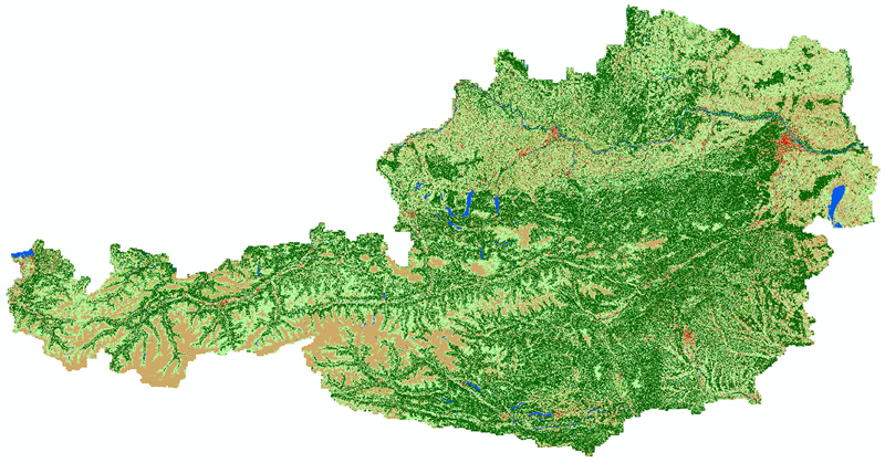
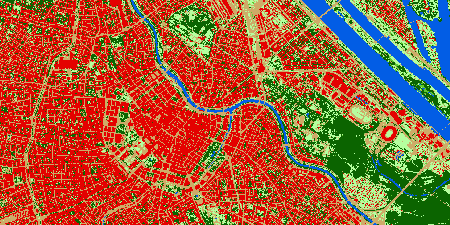
Land Cover: Precise Data for Austria 04.12.2024 - The Federal Office of Metrology and Surveying - BEV presents its new product “Land Cover”: a high-resolution, free dataset that provides information on vegetation, buildings, soil areas and water bodies. Ideal for analysis, planning and environmental monitoring.
With Land Cover, the BEV has developed a new product that provides precise information on physical land cover in Austria. The dataset distinguishes between six classes: high, medium and low vegetation, buildings, soil areas and water bodies. This detailed representation is based on remote sensing data, including digital orthophotos and elevation models, and is available at a resolution of 20 cm.
Area-wide for the First Time
This first area-wide, high-resolution land cover dataset contains information on land cover through a homogeneous Austria-wide classification and enables a detailed division into six land cover classes: high, medium and low vegetation, buildings, land surfaces and water bodies.
The Land Cover data is derived from state-of-the-art remote sensing data, including
- digital aerial images
- digital orthophotos
- digital surface models from aerial photographs
- digital terrain elevation models from ALS aerial surveys

Wide Range of Applications
Land Cover is suitable as a basis for
- Change and environment analyses
- Land use studies
- Planning tasks
- Integration into geographic information systems (GIS)
However, the data set is not suitable for applications such as the determination of parcel boundaries, 3D analyses or the exact determination of the degree of sealing. For some of these questions, the Land Cover product can be a data set that supports analyses based on other data sets (e.g. satellite data - Copernicus).
Highly Automated Data Processing
The data is generated by an automated classification process that analyzes pixels based on spectral, geometric and spatial properties. While gross errors are corrected manually, data processing is deliberately kept to a minimum to ensure robust, efficient production.

Available Free of Charge and Uncomplicated
The Land Cover dataset is available to download free of charge and is offered in a cloud-optimized GeoTIFF format (COG-TIFF). The data is updated every three years and is available approximately two years after an Austria-wide aerial survey.
Land Cover is now available free of charge on the BEV geoportal at data.bev.gv.at and as a network service (WMS).
One can use Land Cover to document the development of our landscapes and to analyze changes in vegetation, settlement structures or water bodies.
Further information can be found on our website at bev.gv.at.
With Land Cover, the BEV creates a valuable basis for science, administration and planning - precise, up-to-date and free of charge.